1850 Perthes Map of Bohemia
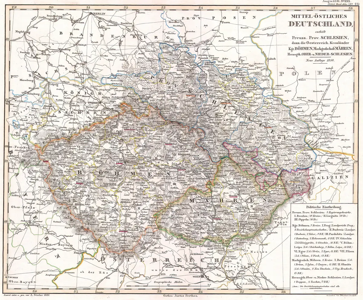
Click or tap the map to enlarge it.
This map of Bohemia, the western historic region of the Czech Republic, was published in 1850 by the Justus Perthes firm of Gotha in Germany. The sheet is a fine example of mid-nineteenth-century German cartography, with detailed lettering for towns, rivers and administrative districts.
It was reproduced by the antique map dealer Geographicus, and the image is in the public domain through the age of the original.
Bohemia in 1850
In 1850 Bohemia was a crown land of the Austrian Empire, with Prague as its capital. The revolutions of 1848 had just been suppressed, and the empire was introducing administrative reforms. The map shows the region as a roughly diamond-shaped basin ringed by mountains, with the Elbe and Vltava rivers draining towards the north. Place names are given in German, the administrative language of the time, since Czech names were not widely used on official maps.
Czech-speaking Bohemia also contained a large German-speaking minority, especially in the border regions.
The Perthes firm
Justus Perthes founded his Gotha geographical publishing house in 1785. It became famous for Stieler's Hand-Atlas, whose first edition was issued between 1816 and 1823, and for its fine copper engraving. A Perthes sheet is often a good source for historical place names and administrative boundaries.
Why Gotha
Gotha, in Thuringia, was the home of the Perthes firm for more than two centuries. The company published the Almanach de Gotha, the genealogical directory of Europe's royal families, and from 1855 the journal Petermanns Geographische Mitteilungen, which carried reports from explorers around the world. A map from Gotha carried a reputation for careful compilation, which is why Perthes sheets are still prized by collectors and researchers.
Key facts
| Fact | Detail |
|---|---|
| Publisher | Justus Perthes, Gotha |
| Date | 1850 |
| Political status | Crown land of the Austrian Empire |
| Capital | Prague |
| Main rivers | Elbe and Vltava |
Questions about this map
Why are the names in German?
German was the administrative language in the Austrian Empire in 1850.
What is Geographicus?
A dealer that sells and documents antique maps; it supplied the scan.
What is Bohemia today?
The western part of the Czech Republic, with Prague as its capital.