Hindoostan Map, 1831
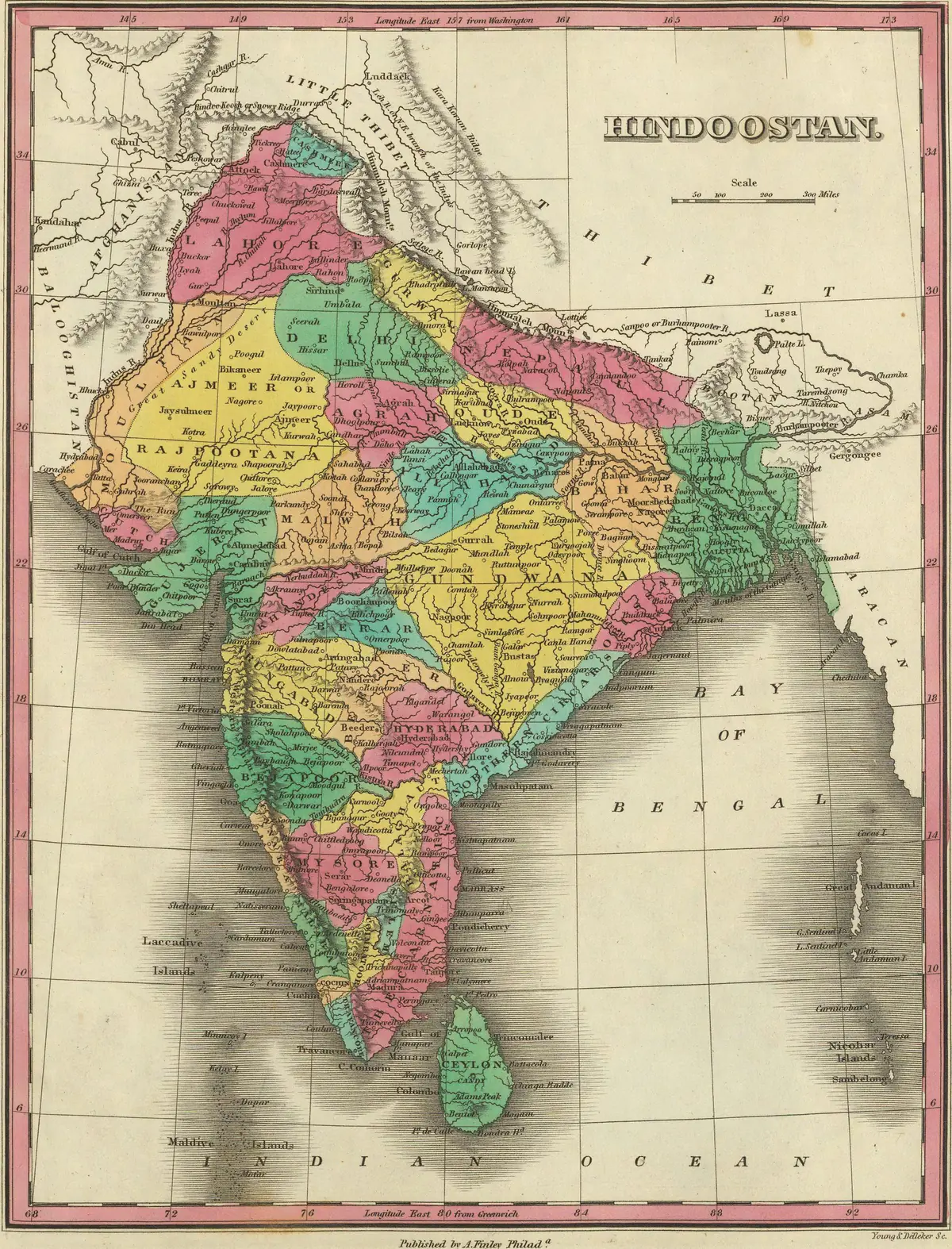
Click or tap the map to enlarge it.
This hand-coloured map of 'Hindoostan' was published in 1831 by Anthony Finley of Philadelphia as part of an American atlas. It shows India and the surrounding lands, with regions picked out in colour and the terrain shown by shading.
The spelling 'Hindoostan' was a common English rendering of Hindustan, the Persian-derived name for northern India.
India in 1831
At this date most of India was ruled or controlled by the East India Company, which administered the presidencies of Bengal, Madras and Bombay, and held treaties with many princely states. The Company's monopoly on trade with India was ended in 1813, and its charter was renewed in 1833 with new restrictions. The map shows political divisions as understood by a commercial publisher in the United States, not a survey made for the Company.
Towns, rivers and coastlines are marked with the older spellings of the period, such as Calcutta and Bombay.
What to look for
Compare the colours and borders with a modern map to see how many princely states survived into the twentieth century, and where the British-held territories lay. The map also shows neighbouring areas such as Nepal, Bhutan, Burma and Ceylon, labelled with the names then in use.
Key facts
| Fact | Detail |
|---|---|
| Publisher | Anthony Finley, Philadelphia |
| Date | 1831 |
| Ruling power in much of India | East India Company |
| Presidencies | Bengal, Madras and Bombay |
Questions about this map
Why is it spelled Hindoostan?
It was a standard English spelling at the time.
Who was Anthony Finley?
A Philadelphia publisher of atlases and maps.
Is this a British survey?
No, it was published in the United States from existing sources.