Ogilby’s Maps of Old London
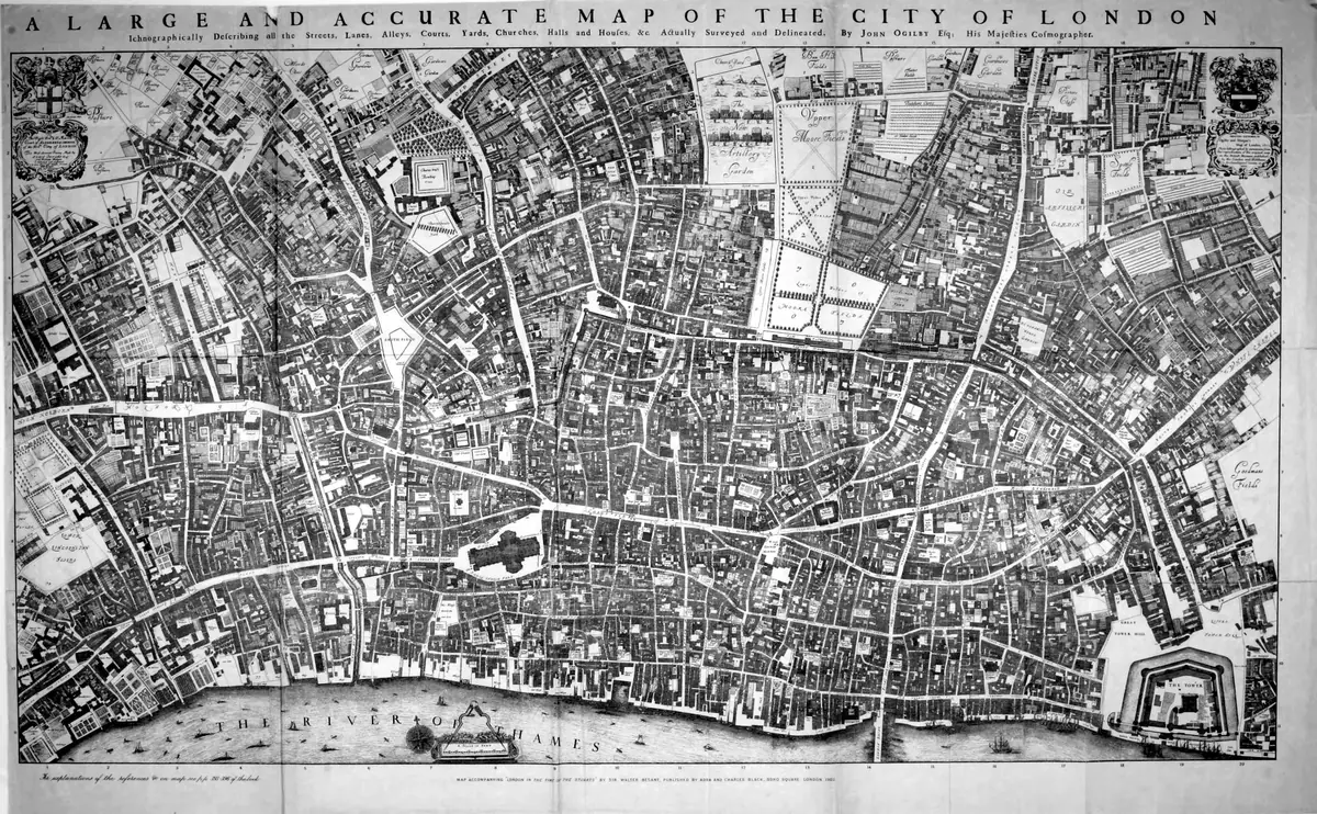
Click or tap the map to enlarge it.
This sheet is drawn from John Ogilby and William Morgan's large map of London, published in 1676. It shows the rebuilt city a decade after the Great Fire of 1666 in dense detail, with individual buildings, streets, alleys and courts.
The map was drawn at a scale of 100 feet to the inch and engraved on 20 sheets, which made it the first large-scale map of the city.
Mapping a city after the fire
The Great Fire of September 1666 destroyed about 13,000 houses and 87 parish churches within the old walls. Rebuilding began almost at once, and Ogilby and Morgan's survey recorded the city as it emerged, with new brick buildings and wider streets. It was among the first maps to draw each building as a footprint rather than as a small picture.
Ogilby was already known for Britannia, a road atlas published in 1675 with strip maps of the main routes of England and Wales. The London map was completed by William Morgan, his wife's grandson, after Ogilby's death in 1676.
Using it today
Historians use the map to study the layout of the post-fire city, to trace streets that have since been renamed or lost, and to understand the property patterns of London's merchants. Because the sheet is in the public domain, many versions are available in libraries and archives.
Key facts
| Fact | Detail |
|---|---|
| Date | 1676 |
| Scale | 100 feet to the inch |
| Sheets | 20 |
| Context | Rebuilt city after the Great Fire of 1666 |
| Earlier work | Britannia road atlas, 1675 |
Questions about this map
Who made the map?
John Ogilby and William Morgan.
Why was the survey needed?
The Great Fire had destroyed much of the old city, and the rebuilt streets needed to be recorded.
Is the map accurate?
It was surveyed on the ground at an unusually large scale and is a valuable record.