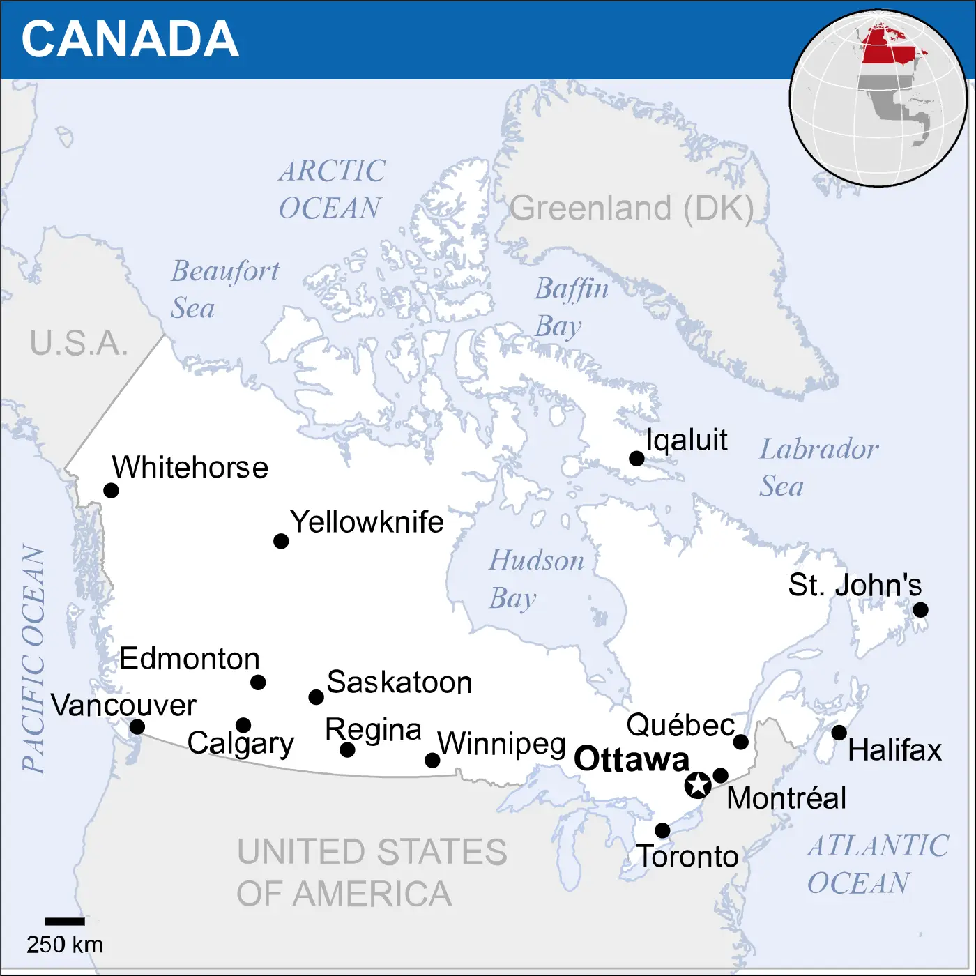
Canada Location Map 2017 with Yellowknife and Saskatoon
Click or tap the map to enlarge it.
Key Takeaways
- Canada Location Map 2017 marks the geographical features of the country.
- Yellowknife and Saskatoon are highlighted on the map, showcasing their importance.
- Exploring this map provides insights into the diverse landscapes of Canada.
History
The Canada Location Map 2017 with Yellowknife and Saskatoon is an important tool for understanding the geographical
layout of Canada and the specific locations of Yellowknife and Saskatoon within the country. This map provides a
valuable representation of Canada’s vast and diverse landscapes.
Yellowknife
Yellowknife, the capital of Canada’s Northwest Territories, is located on the northern shore of Great Slave Lake.
It is an essential city in Canada’s mining industry and serves as a gateway to the natural beauty of the North. The
map highlights Yellowknife, indicating its significance within the country.
Saskatoon
Saskatoon, situated in the Canadian province of Saskatchewan, lies on the South Saskatchewan River. It is the
largest city in the province and plays a vital role in Canada’s agricultural industry. The map identifies Saskatoon
as an important urban center within Canada.
Unique Insights
- The Canada Location Map 2017 provides a visual representation of the vastness of Canada’s landscapes, from its
arctic regions to its prairies. - Yellowknife’s location on the northern shores of Great Slave Lake is evident on the map, emphasizing its
proximity to this significant water body. - Saskatoon’s positioning along the South Saskatchewan River is effectively depicted, showcasing its connection to
this essential waterway. - The map indicates the vastness of Canada’s wilderness and the relative sparse population across the country’s
geographical expanse. - Through this map, it becomes apparent how Yellowknife and Saskatoon serve as focal points within Canada due to
their respective roles in mining and agriculture.
Table of Relevant Facts (2017)
| Fact | Description |
|---|---|
| Area | Canada is the second-largest country in the world, covering approximately 9.98 million square kilometers. |
| Population | In 2017, Canada’s population was estimated to be approximately 36.29 million people. |
| Yellowknife | Yellowknife had a population of about 19,569 with a land area of 105.47 square kilometers. |
| Saskatoon | Saskatoon had a population of around 246,376 with a land area of 228.13 square kilometers. |
Frequently Asked Questions
1. What is the purpose of the Canada Location Map 2017 with Yellowknife and Saskatoon?
The purpose of this map is to visually represent the geographical features of Canada, highlighting Yellowknife and
Saskatoon’s location within the country.
2. Why is Yellowknife important?
Yellowknife is significant due to its role as the capital of Canada’s Northwest Territories and its involvement in
the mining industry.
3. What are the main industries in Saskatoon?
Saskatoon is known for its thriving agricultural industry, with farming and food processing being major economic
contributors to the city.
4. How large is Canada?
Canada is the second-largest country in the world, covering approximately 9.98 million square kilometers.
5. What natural feature is Yellowknife situated near?
Yellowknife is located on the northern shore of Great Slave Lake, one of Canada’s largest lakes.
6. What significant river runs through Saskatoon?
Saskatoon lies along the South Saskatchewan River, an important waterway in the country.
7. How many people live in Canada?
In 2017, Canada’s population was estimated to be approximately 36.29 million people.