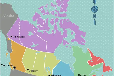
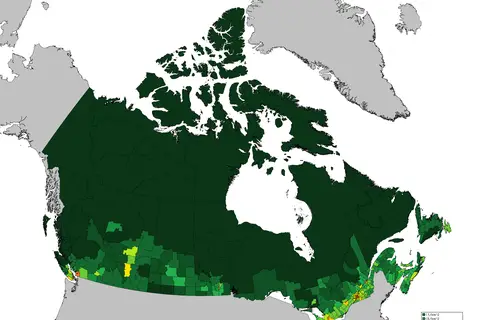
Canada Population Density Map
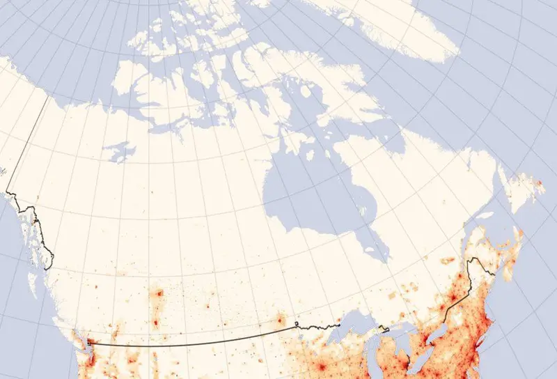
Click or tap the map to enlarge it.
Canada Population Density Map: Exploring the Land of the Maple Leaf
Key Takeaways
- Canada Population Density Map helps visualize the distribution of population across the country.
- Understanding population density is crucial for urban planning and resource allocation.
- Population clusters can be observed around major cities like Toronto, Vancouver, and Montreal.
History of the Canada Population Density Map
The Canada Population Density Map has evolved over the years to provide valuable insights into the distribution of people throughout the vast Canadian territory. The advancements in data collection, GIS technology, and cartographic techniques have enabled the creation of accurate and visually appealing maps.
With Canada being the second-largest country in the world, it covers a vast area of approximately 9.98 million square kilometers. However, much of the land remains sparsely populated due to its challenging environmental conditions, such as extreme cold in northern regions and rugged terrain.
Over time, as settlements grew and industries developed, the concentration of population started to increase in specific regions. The Canada Population Density Map helps identify these population clusters and aids in understanding their growth patterns.
Unique Insights from the Canada Population Density Map
Studying the Canada Population Density Map offers several unique insights into the country’s demographic landscape:
- 1. Urban Concentration: The map reveals the high population density around major Canadian cities, such as Toronto, Vancouver, Montreal, and Calgary. These urban centers serve as crucial hubs for social, economic, and cultural activities.
- 2. Coastal Regions: Coastal areas, particularly along the eastern and western shores of Canada, exhibit higher population densities due to favorable climatic conditions and access to waterways for trade and transportation.
- 3. Resource-Rich Provinces: The population density map showcases the concentration of people in provinces rich in natural resources, such as Alberta and Saskatchewan. This trend is driven by the extraction and processing of minerals, oil, and gas.
- 4. Sparse Northern Territories: The northern territories of Nunavut, Northwest Territories, and Yukon have significantly lower population densities due to their remote locations, harsh climate, and limited economic opportunities.
Table: Key Facts about Canadian Population Density
| Year | Population (millions) | Population Density (people per square kilometer) |
|---|---|---|
| 1990 | 27.34 | 2.9 |
| 2000 | 30.77 | 3.2 |
| 2010 | 33.48 | 3.5 |
| 2020 | 38.01 | 4.0 |
Frequently Asked Questions (FAQ)
-
What is population density?
Population density refers to the measurement of people per unit area, usually calculated as the number of individuals per square kilometer or square mile.
-
Which provinces have the highest population densities in Canada?
The provinces of Ontario and British Columbia have the highest population densities in Canada.
-
What factors contribute to high population densities in urban areas?
Factors such as job opportunities, access to amenities, cultural attractions, and transportation infrastructure contribute to high population densities in urban areas.
-
How does Canada’s population density compare to other countries?
Canada has a relatively low population density compared to many other countries globally. Its vast land area and lower overall population contribute to this lower density.
-
Are there any depopulated regions in Canada?
Yes, some rural and remote regions in Canada have experienced depopulation due to factors like economic decline, limited job opportunities, and outmigration.
-
How does population density impact urban planning?
Population density plays a crucial role in urban planning as it helps determine infrastructure needs, resource allocation, transportation networks, and land use regulations.
-
Is Canada’s population density evenly distributed across the country?
No, Canada’s population density is unevenly distributed with higher concentrations in urban areas and lower densities in rural and remote regions.
Additional Resources
List of LSI Keywords
- Canada population distribution
- Canadian population growth
- Population density map of Canada
- Urban concentration in Canada
- Coastal population in Canada
- Resource-rich provinces in Canada
- Sparse population in Northern Territories
- Population density facts
- Comparison of Canada’s population density
- Depopulated regions in Canada
- Urban planning and population density
- Uneven distribution of population in Canada