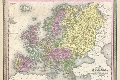
Europe 19291938 Political Map
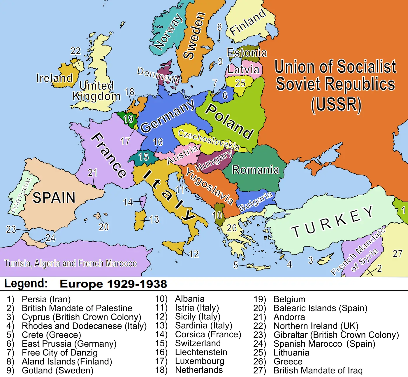
Click or tap the map to enlarge it.
Europe 1929-1938 Political Map – A Detailed Overview
Key Takeaways
- Europe’s political landscape between 1929 and 1938 saw significant changes and tensions.
- The map showcases the shifting borders, alliances, and power dynamics during this time.
- Understanding the historical context is crucial to grasp the complexities of Europe’s political history.
History
The period between 1929 and 1938 was marked by immense political and economic turmoil in Europe. The aftermath of World War I, economic depression, and rising tensions laid the groundwork for the tumultuous events that unfolded during these years. This article aims to provide a detailed overview of the political map during this time, highlighting key events and changes in the region.
Political Shifts and Alliances
The map of Europe between 1929 and 1938 illustrates numerous political shifts and alliances that had a significant impact on the continent. Following the end of World War I, the Treaty of Versailles imposed substantial territorial changes and limitations on Germany and its allies, redrawing the political boundaries across Europe.
One of the notable events during this period was the rise of fascist regimes in several European countries. In Italy, Benito Mussolini’s National Fascist Party came to power in 1922, establishing a totalitarian regime. Adolf Hitler’s National Socialist German Workers’ Party gained influence in Germany, eventually leading to his appointment as Chancellor in 1933.
The map reflects the emergence of the Soviet Union as a major power. Under Joseph Stalin’s leadership, the Soviet Union underwent massive industrialization and collectivization programs, solidifying its status as a global contender.
The tumultuous nature of Europe during these years is depicted by the shifting alliances and geopolitical tensions. Germany, Italy, and Japan formed the Axis Powers, aiming to expand their territories and challenge the existing world order. On the other side, an alliance known as the Little Entente was formed by Czechoslovakia, Romania, and Yugoslavia to counter aggression from neighboring countries.
Conflicts and Border Disputes
The political map of Europe between 1929 and 1938 also shows the presence of several conflicts and border disputes. The Spanish Civil War (1936-1939) exhibited the ideological divisions within Europe, with various international actors supporting either the Republicans or the Nationalists. While the Republicans were backed by the Soviet Union and left-wing volunteers from other countries, the Nationalists received support from fascist Italy and Nazi Germany.
The map displays the remilitarization of the Rhineland by Germany in 1936, a move that violated the Treaty of Versailles. The event heightened tensions in Europe and was a significant step towards the outbreak of World War II.
Unique Insights
Examining the Europe 1929-1938 political map provides unique insights into this transformative period. Here are a few key observations:
- Changing Borders: The map showcases the changing borders as a result of the redrawing of political boundaries post-World War I.
- Fascist Influence: The rise of fascist regimes in Italy and Germany had a significant impact on the political landscape of Europe.
- Emergence of the Soviet Union: The map reflects the increasing influence and power of the Soviet Union during this time.
- Axis Powers: The formation of the Axis Powers by Germany, Italy, and Japan threatened the existing world order and led to tensions with other nations.
- Conflicts and Border Disputes: The presence of conflicts such as the Spanish Civil War and border disputes added to the political unrest in Europe.
Table of Relevant Facts (1929-1938)
| Year | Event |
|---|---|
| 1929 | The Wall Street Crash triggers a global economic depression. |
| 1933 | Adolf Hitler becomes Chancellor of Germany. |
| 1936 | Germany remilitarizes the Rhineland. |
| 1936-1939 | The Spanish Civil War takes place. |
| 1938 | The Munich Agreement is signed, granting Germany control over the Sudetenland. |
FAQ
1. What were the main political changes in Europe between 1929 and 1938?
Europe saw the rise of fascist regimes, the emergence of the Soviet Union as a major power, and the formation of alliances such as the Axis Powers.
2. Which countries were part of the Axis Powers?
The Axis Powers consisted of Germany, Italy, and Japan.
3. How did the Treaty of Versailles impact Europe’s political map?
The Treaty of Versailles imposed territorial changes and limitations on Germany and its allies, resulting in a redrawing of political boundaries.
4. What were the key events leading to World War II during this period?
Events such as Hitler becoming Chancellor, the Spanish Civil War, and the remilitarization of the Rhineland heightened tensions that eventually led to the outbreak of World War II.
5. What were the ideological divisions in the Spanish Civil War?
The Spanish Civil War witnessed divisions between the Republicans (supported by the Soviet Union and left-wing volunteers) and the Nationalists (supported by fascist Italy and Nazi Germany).
6. How did Europe’s political map change after 1938?
Europe’s political map underwent further transformations as a result of World War II and subsequent events.
7. How can I learn more about Europe’s political history during this time?
For a more in-depth exploration of Europe’s political history between 1929 and 1938, you can refer to the following external resources: