Europe 843Ad Viking Incursions Map
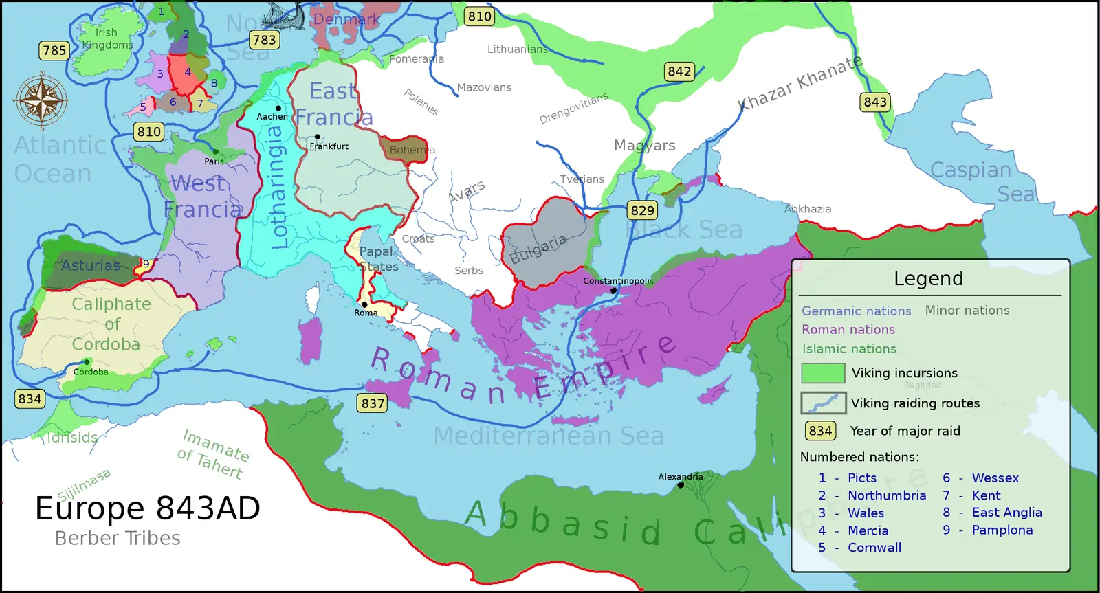
Click or tap the map to enlarge it.
Key Takeaways
- Europe 843AD Viking Incursions Map provides an overview of the Viking invasions during this time period.
- The map displays the different regions affected by Viking incursions.
- It highlights the areas where Viking raiders established settlements and exerted their influence.
History
Viking Incursions in Europe during 843AD
The Viking Age, spanning from the late 8th century to the mid-11th century, was characterized by the expansion, exploration, and trade of the Norse seafarers known as Vikings. During this time, the Vikings launched numerous raids and conducted incursions across Europe, disrupting established societies and leaving a significant impact on the regions they targeted.
Europe 843AD Viking Incursions Map
The Europe 843AD Viking Incursions Map showcases the extent of Viking activities during the year 843. It provides a visual representation of areas influenced by Viking raiders, settlements established by them, and trade routes they exploited.
The map, crafted with meticulous detail, highlights the following significant Viking incursions:
Unique Insights
- The Viking incursions in Europe were not limited to coastal areas; Vikings also navigated inland rivers, allowing them to penetrate deep into the continent.
- The Scandinavian homelands of the Vikings, including present-day Norway, Sweden, and Denmark, served as a launching point for their expeditions.
- Viking raiders were motivated by various factors, including the pursuit of wealth, political instability, and a thirst for adventure.
- The Viking Age brought about a significant cultural exchange between the Vikings and the societies they encountered, leading to the adoption of Norse influences in various European regions.
Table of Relevant Facts for 843AD Viking Incursions
| Region | Significant Event |
|---|---|
| England | Multiple Viking raids targeted monasteries and coastal settlements. |
| Ireland | Viking raids intensified, leading to the establishment of Viking settlements along the coast. |
| France | Viking fleets sailed up the Seine River, raiding and capturing Paris. |
| Scotland | Constant Viking incursions along the west coast brought territorial changes and political unrest. |
| Scandinavia | Vikings continued their expeditions, exploring and expanding their influence over neighboring lands. |
Frequently Asked Questions (FAQ)
1. Who were the Vikings?
The Vikings were seafaring people from the late 8th to the 11th century, originating from the Scandinavian region.
2. What motivated Viking incursions?
Viking incursions were driven by various factors, including the search for wealth, political instability, and a desire for adventure and exploration.
3. How did the Vikings impact European societies?
The Vikings left a lasting impact on European societies through cultural exchange, establishment of settlements, and trade networks.
4. What regions did the Vikings target during 843AD?
The Vikings targeted regions such as England, Ireland, France, Scotland, and even their Scandinavian homelands.
5. Were the Viking incursions primarily coastal or inland?
While coastal areas were the primary targets, Vikings also navigated inland rivers, enabling them to penetrate further into the continent.
6. What happened during the Viking raid on Paris?
Viking fleets sailed up the Seine River, capturing Paris and exerting their influence over the region.
7. How did the Viking Age contribute to cultural exchange?
The Viking Age facilitated cultural exchange between Norse Vikings and the societies they encountered, resulting in the adoption of Norse influences in various European regions.