Map of the Assyrian Empire
Key Takeaways
- The Map of the Assyrian Empire showcases the territorial boundaries and important cities of the ancient Assyrian Empire.
- It provides a visual representation of the vast expansion and influence of the Assyrian Empire during its height.
- Studying this map helps understand the historical context, geopolitical dynamics, and cultural impact of the Assyrian Empire.
History of the Assyrian Empire
The Assyrian Empire was one of the most powerful empires of the ancient world. It emerged in the Late Bronze Age, around 934 BCE, in the region of modern-day Iraq. The empire reached its peak during the reign of Tiglath-Pileser III (745–727 BCE) and lasted until the fall of Nineveh in 612 BCE.
During its existence, the Assyrian Empire expanded its territory through military conquests, assimilating different cultures and ruling over a vast multicultural population. The empire was known for its well-organized administration, advanced military tactics, and efficient communication network.
Unique Insights
Studying the Map of the Assyrian Empire can provide valuable insights into various aspects of ancient history:
- The empire’s capital, Nineveh, was a significant center of civilization and had impressive architectural marvels such as the renowned Hanging Gardens.
- The empire had a highly efficient road system, connecting the major cities and facilitating trade and communication.
- Assyrian kings were notorious for their brutality in war, often conducting harsh military campaigns to maintain dominance and control.
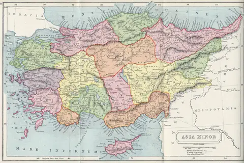
- The empire’s territories included parts of modern-day Iraq, Syria, Iran, and Turkey, exerting influence across the Near East.
Table of Relevant Facts
| Year | Event |
|---|---|
| 934 BCE | Emergence of the Assyrian Empire |
| 745–727 BCE | Reign of Tiglath-Pileser III |
| 612 BCE | Fall of Nineveh |
Frequently Asked Questions (FAQ)
-
When did the Assyrian Empire exist?
The Assyrian Empire existed from 934 BCE to 612 BCE.
-
What were the achievements of the Assyrian Empire?
The Assyrian Empire achieved great military conquests, built monumental architecture, and established a well-organized administration.
-
Which cities were important in the Assyrian Empire?
Nineveh, Ashur, and Nimrud were among the important cities in the Assyrian Empire.
-
How did the Assyrian Empire communicate over long distances?
The Assyrian Empire had an advanced communication network using a system of relays and horse messengers.
-
What led to the fall of the Assyrian Empire?
The Assyrian Empire faced internal rebellions, external invasions, and a weakening of its central power, ultimately leading to its downfall.
-
What impact did the Assyrian Empire have on the region?
The Assyrian Empire left a lasting impact on the region by influencing culture, architecture, and political systems.
-
Are there any ancient artifacts or ruins pertaining to the Assyrian Empire?
Yes, many artifacts and ruins have been discovered, including the famous winged bull statues and intricate palace reliefs.