Map Showing Richmond City, Virginia
Click or tap the map to enlarge it.
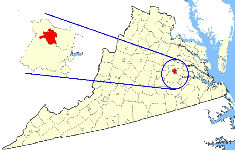
This locator map places Richmond, the capital of Virginia, within the state's pattern of counties and independent cities. Highlighting and an inset circle draw attention to Richmond's position in the east of the state.
Locator maps like this one answer a simple question first: where is it? Richmond sits at the head of navigation on the James River, roughly 100 miles from the Atlantic coast and about 100 miles south of Washington, D.C.
Why Richmond is drawn as its own unit
Virginia is unusual in the United States because its cities are legally separate from the counties around them. Richmond is one of 38 independent cities, which means it is not part of Henrico or Chesterfield County even though it is surrounded by them. On a county map the city therefore appears as its own shape, and that is why a locator map needs to highlight it separately.
The fall line of the James River, where the river drops from the Piedmont toward the coastal plain, explains the site. Ships could travel upstream no further than the rapids, so a trading settlement grew at the falls and was laid out as a town by William Byrd II in 1737.
Capital of Virginia, capital of the Confederacy
The Virginia capital moved from Williamsburg to Richmond in 1780, partly because the inland site was safer from attack during the Revolutionary War. When Virginia seceded in 1861, Richmond became the capital of the Confederate States and remained so until Union forces took the city in April 1865. Much of the historic Shockoe Bottom and Church Hill districts, and the Virginia State Capitol designed by Thomas Jefferson, survive from this long history.
Key facts
| Fact | Detail |
|---|---|
| Status | Independent city and capital of Virginia |
| Laid out as a town | 1737, by William Byrd II |
| State capital since | 1780 (moved from Williamsburg) |
| Confederate capital | 1861 to 1865 |
| Population (2020 census) | 226,610 |
| Main river | James River, at the fall line |
Questions about this map
Is Richmond part of a county?
No. Richmond is an independent city, so it sits outside any county, although it is surrounded by Henrico and Chesterfield counties.
Why is the capital not on the coast?
Colonial Virginia's first capitals, Jamestown and then Williamsburg, were near the coast. Richmond became capital in 1780 because an inland site was easier to defend and sat at the centre of the state's growing population.
What does the James River do for the city?
The James provided the water power and the head of navigation that made Richmond a trading and manufacturing town, and today it runs through the city as the James River Park System.