Río de la Plata Map: Buenos Aires and Montevideo
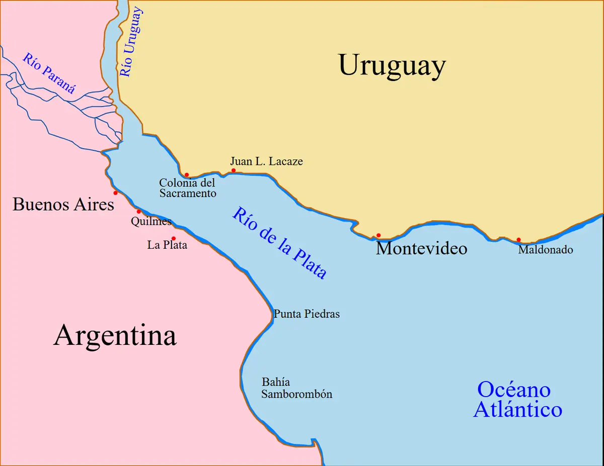
Click or tap the map to enlarge it.
This map shows the Río de la Plata, the broad estuary that separates Argentina from Uruguay, with Buenos Aires on the south-west shore and Montevideo on the north-east shore.
The Río de la Plata is formed where the Paraná and Uruguay rivers meet. It is roughly 290 kilometres long and widens to about 220 kilometres where it opens into the South Atlantic.
A river that looks like a sea
Although it is called a river, the Plata is an estuary: fresh water from one of South America's largest river systems mixes with salt water from the Atlantic. The water is often brown because of the sediment carried down the Paraná and Uruguay, and the shallow channels have always demanded careful navigation, which is one reason charts of the estuary have a long history.
Buenos Aires and Montevideo face each other across the water. Fast ferries and flights link them, and the road route runs north around the estuary via the bridge at Fray Bentos.
Exploration and settlement
The Spanish navigator Juan Díaz de Solís entered the estuary in 1516 and was killed on its shore. Buenos Aires was first founded by Pedro de Mendoza in 1536 and re-established by Juan de Garay in 1580. Montevideo was founded in the 1720s as a Spanish military outpost, partly to counter the Portuguese colony of Colonia del Sacramento, which lies across the bay from Buenos Aires. In 1776 Spain created the Viceroyalty of the Río de la Plata with Buenos Aires as its capital.
Key facts
| Fact | Detail |
|---|---|
| Type | Estuary formed by the Paraná and Uruguay rivers |
| Length | About 290 km |
| Width at the mouth | About 220 km |
| First European visit | Juan Díaz de Solís, 1516 |
| Buenos Aires re-founded | 1580 |
| Viceroyalty created | 1776 |
Questions about this map
Is the Río de la Plata a river or a sea?
It is an estuary, a partly salty body of water where two rivers meet the ocean.
What does 'Plata' mean?
It is Spanish for silver. Early explorers hoped the region would lead to silver, though little was found.
Which countries share the Plata?
Argentina and Uruguay.