Map of the City of Rio de Janeiro
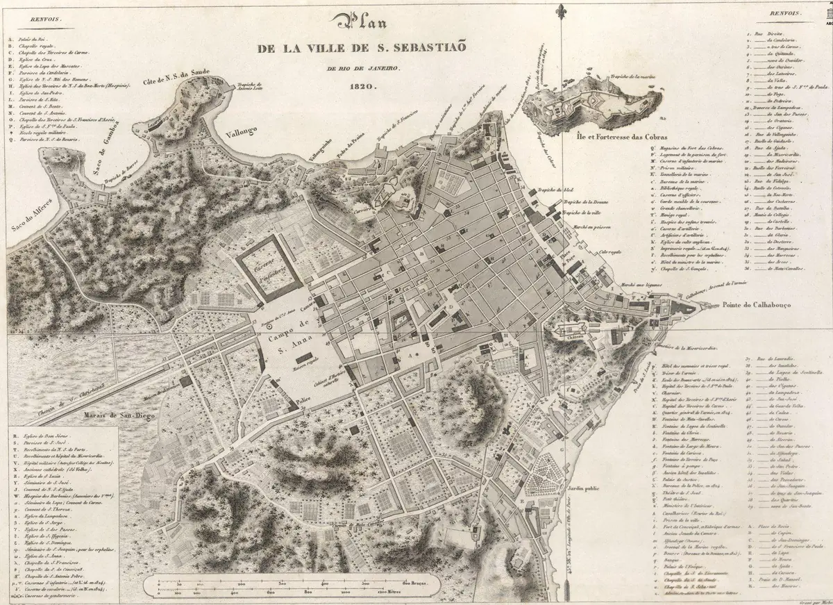
Click or tap the map to enlarge it.
This early plan of Rio de Janeiro shows the city as a compact grid of streets squeezed between hills, a bay and fortifications. Wikimedia Commons credits it to Jacques Arago, a French artist and writer who visited Rio in 1817 and 1818 on a scientific voyage, and the plan is in the public domain.
Reading a plan from this period is a way to see what the city looked like before the great landfill projects and tunnels of the twentieth century.
What an early plan of Rio shows
The centre of old Rio was a small area beside Guanabara Bay, bounded by the hills of Castelo, São Bento and Santo Antônio. Churches, forts and the line of the shore are the key landmarks, and the street grid is far smaller than the modern metropolis. Many of the low-lying areas shown as water or marsh were later filled in.
When the Portuguese royal court arrived in 1808, fleeing Napoleon's army, Rio suddenly became the capital of an empire. The decades that followed brought new institutions, a botanical garden, a royal library and a rapid increase in population, which is the period in which plans like this were produced.
From colonial port to capital and back
Rio was founded in 1565 by Estácio de Sá as a Portuguese stronghold against French settlers. It became the seat of the viceroy in 1763 and remained Brazil's capital until the federal government moved to the purpose-built city of Brasília, inaugurated on 21 April 1960. Today Rio is the second-largest city in Brazil after São Paulo.
Key facts
| Date | Event |
|---|---|
| 1502 | Portuguese navigators reach Guanabara Bay and name it the River of January |
| 1565 | City founded by Estácio de Sá |
| 1763 | Becomes the seat of the Viceroyalty and capital of Brazil |
| 1808 | Portuguese royal court arrives from Lisbon |
| 1822 | Brazil declares independence from Portugal |
| 1960 | Capital function moves to Brasília |
Questions about this map
Why was Rio built beside hills and a bay?
The sheltered Guanabara Bay made an excellent harbour, and the steep granite hills offered defensible positions for forts.
Who made this map?
Wikimedia Commons credits the plan to Jacques Arago, who travelled with the Freycinet expedition. Because the work is old, it is in the public domain.
Is Rio still Brazil's capital?
No. Brasília has been the capital since 1960.