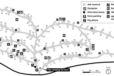
Muir Woods Trail Map (NPS)
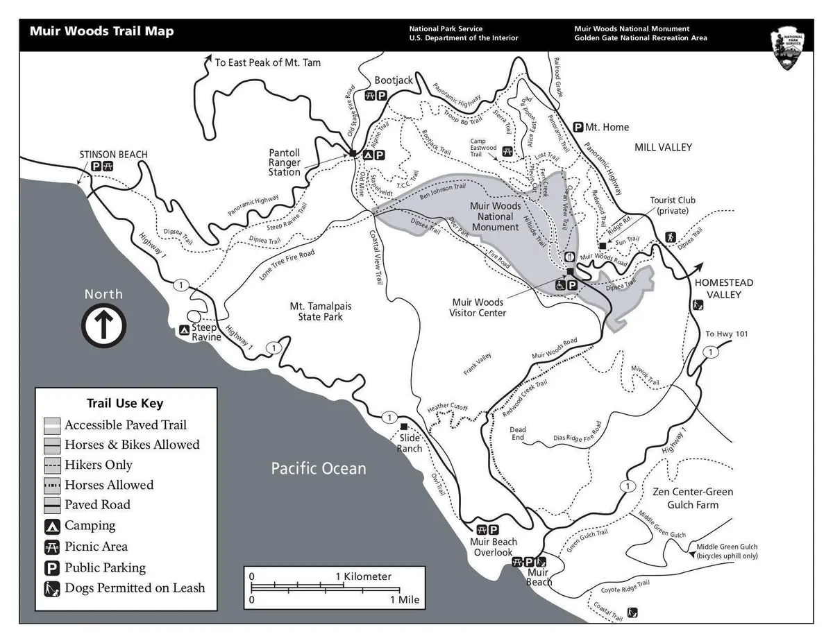
Click or tap the map to enlarge it.
This trail map from the National Park Service shows the hiking paths in Muir Woods National Monument in Marin County, California, about 12 miles north of San Francisco, as well as the surrounding area.
The monument protects a grove of old-growth coast redwoods, Sequoia sempervirens, the tallest tree species on Earth. Some of the trees in Muir Woods are more than 250 feet tall.
History of the monument
The land was bought by William Kent and his wife Elizabeth Thacher Kent in 1905 and donated to the federal government. President Theodore Roosevelt proclaimed it a national monument on 9 January 1908. At the Kents' request it was named for the naturalist John Muir, who had helped to inspire the conservation movement.
The main trail along Redwood Creek is flat and accessible and leads through Cathedral Grove, while longer trails climb to the ridge above and connect to Mount Tamalpais State Park.
Planning a visit
The park limits the number of cars and offers a shuttle and reservation system because of heavy visitor numbers, so plan ahead and check current requirements on the park's website. A map like this one helps in choosing a loop of the right length, and shows trail junctions, bridges and exits.
The redwoods of Muir Woods
Coast redwoods in Muir Woods commonly reach ages of 500 to 800 years, and the oldest are estimated at around 1,200. They depend on summer fog, which supplies much of their water. Redwood Creek, which runs through the valley, supports coho salmon and steelhead trout. The tallest trees in the grove exceed 250 feet. The monument is small, only a little more than 500 acres, so careful management of visitors is important.
Key facts
| Fact | Detail |
|---|---|
| Location | Marin County, California |
| Declared a national monument | 9 January 1908 |
| Named for | John Muir |
| Main trees | Coast redwoods |
| Map source | National Park Service |
Questions about this map
Who gave the land?
William and Elizabeth Thacher Kent donated it in 1908.
Do I need a reservation?
Often yes. Check the park's website for current rules.
Are the trails flat?
The main boardwalk trail is flat; others are steeper.