U.S. Regional Accreditation Map
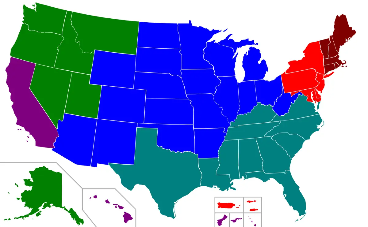
Click or tap the map to enlarge it.
This map of the United States divides the country into the regions served by the regional accrediting agencies for colleges and universities, with a different colour for each. In the United States, accreditation is a voluntary system of peer review, recognised by the federal government, that determines eligibility for federal student aid.
The map dates from 2013 and shows the names the agencies used then, including MSA, NEASC, NCA, NWCCU, SACS and WASC.
Six regions
The Middle States Association covered the mid-Atlantic, the New England Association covered New England, the North Central Association covered the Midwest, the Northwest Commission covered the north-western states, the Southern Association covered the South and the Western Association covered California, Hawaii and the Pacific territories.
Several of these bodies have since changed their names; the North Central Association's higher-education arm became the Higher Learning Commission, for example, and the New England body became NECHE.
A changing system
Until 2020 the Department of Education distinguished between regional and national accreditors, and credits from regionally accredited schools were widely accepted. New rules removed that distinction and allowed accreditors to work across region boundaries. A map of regions is still useful for understanding the history of the system. Students should check a school's current accreditor on the Department of Education database.
Why accreditation matters to students
Students at accredited institutions are generally eligible for federal financial aid, and accreditation influences whether credits transfer between colleges and whether employers and graduate programmes recognise a degree. Individual programmes can also have specialised accreditation, such as engineering by ABET or law by the American Bar Association. The U.S. Department of Education publishes a database of accredited institutions, which is the quickest way to confirm a school's status.
Key facts
| Abbreviation | Area |
|---|---|
| MSA | Mid-Atlantic states |
| NEASC | New England |
| NCA | North Central and Midwest |
| NWCCU | Northwest |
| SACS | Southern states |
| WASC | Western states and Pacific |
Questions about this map
What is accreditation?
A process in which institutions are reviewed by peers against quality standards.
Is the map current?
No, it shows 2013 names and regions.
Where can I check a school's status?
In the Department of Education's database of accredited institutions.