U.S. EIA Map of US Oil Refineries
Click or tap the map to enlarge it.
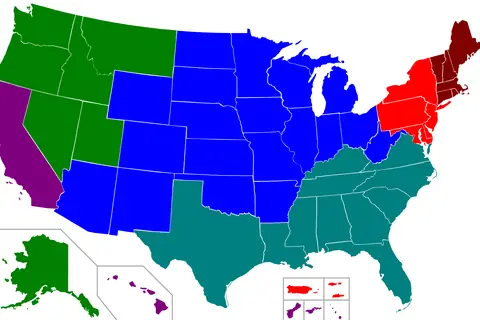
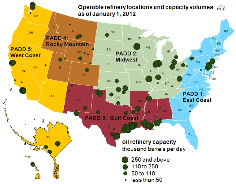
This map from the U.S. Energy Information Administration shows the location and capacity of petroleum refineries in the United States as of 2012, with circles scaled to capacity. The country is split into five PADD regions, Petroleum Administration for Defense Districts, which are used for fuel statistics.
Refining capacity is not spread evenly. The Gulf Coast, PADD 3, which includes Texas and Louisiana, holds roughly half of all US capacity.
The five PADDs
PADD 1 is the East Coast, PADD 2 the Midwest, PADD 3 the Gulf Coast, PADD 4 the Rocky Mountain region and PADD 5 the West Coast. Refineries cluster near ports, pipelines and sources of crude. The Gulf Coast has the largest facilities, such as the refinery at Port Arthur, Texas, while the Rocky Mountain region has many small refineries.
The EIA publishes the map as a public service, and its works are in the public domain.
Why a dated map still helps
Refinery numbers have changed since 2012 as small plants closed and others expanded. Even so, the pattern of capacity along the Gulf Coast and in the Midwest has been stable. Anyone needing current figures should consult the EIA's latest refinery capacity reports.
How capacity is measured
Refinery capacity is usually given in barrels per calendar day, and the EIA publishes a refinery capacity report each year. The number of operating refineries in the United States has fallen from more than 300 in the early 1980s to fewer than 150 by 2012, yet total capacity stayed high because the remaining plants grew larger. This is why a map using circles scaled to capacity gives a better picture than simply counting the dots.
Key facts
| PADD | Region |
|---|---|
| PADD 1 | East Coast |
| PADD 2 | Midwest |
| PADD 3 | Gulf Coast |
| PADD 4 | Rocky Mountain |
| PADD 5 | West Coast |
Questions about this map
What does PADD stand for?
Petroleum Administration for Defense District.
Which region has the most refining capacity?
The Gulf Coast.
Is the map current?
No, it shows 2012 data.