Second World War in Asia, 1937–1942: Map
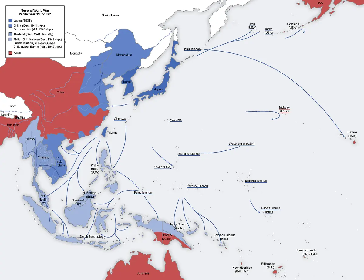
Click or tap the map to enlarge it.
This map traces Japanese expansion in Asia and the Pacific between 1937 and 1942, from the start of full-scale war with China to the high-water mark of Japan's conquests. Territories are coloured by who controlled them and the arrows show the main advances.
The Second World War in Asia began earlier than in Europe. Japan had occupied Manchuria in 1931, and on 7 July 1937 an exchange of fire at the Marco Polo Bridge near Beijing started the second Sino-Japanese War.
China, 1937 to 1941
Japanese forces took Beijing and Tianjin in 1937, fought a three-month battle for Shanghai that autumn, and captured the Chinese capital Nanjing in December, where the atrocities known as the Nanjing Massacre took place. The Chinese government moved inland to Chongqing and continued to resist. By 1941 Japan held most of the main coastal cities and railways but could not defeat China outright.
The offensive of 1941 to 1942
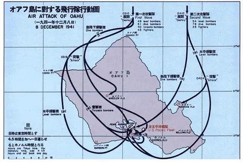
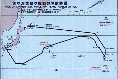
In December 1941 Japan struck almost simultaneously at Pearl Harbor, Malaya, Hong Kong and the Philippines. Hong Kong fell on 25 December 1941 and Singapore on 15 February 1942. Japanese troops overran the Dutch East Indies and most of Burma, and the Philippines surrendered in stages by May 1942. The maximum extent of Japanese control came in mid-1942, shortly before the naval defeat at Midway in June began to shift the balance.
Key facts
| Date | Event |
|---|---|
| 1931 | Japan occupies Manchuria |
| July 1937 | Marco Polo Bridge Incident; war with China widens |
| December 1937 | Fall of Nanjing |
| 7-8 December 1941 | Attacks on Pearl Harbor, Malaya, Hong Kong, Philippines |
| 15 February 1942 | Fall of Singapore |
| June 1942 | Battle of Midway |
Questions about this map
Did the war in Asia start in 1939?
The wider Second World War is usually dated from 1939, but war between Japan and China began in 1937, and many historians trace the roots of the Asian conflict to 1931.
Why did Japan attack in December 1941?
Japan sought the oil and raw materials of Southeast Asia and expected that crippling the US Pacific Fleet would stop interference.
What is shown by the colours?
They indicate the extent of territory controlled by Japan, the Allies and neutral or other states during the period.