Map of the Pala Empire
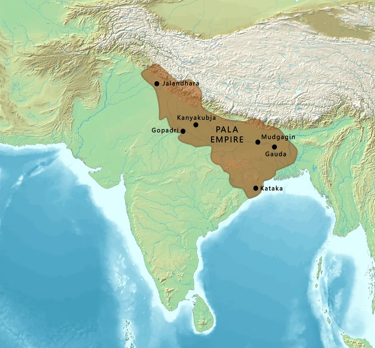
Click or tap the map to enlarge it.
This map outlines the Pala Empire, the Buddhist dynasty that ruled Bengal and Bihar and at times a much wider area of northern India between the 8th and 12th centuries. Places such as Kanyakubja (Kannauj), Gauda, Mudgagiri, Jalandhara and Kataka are marked on a relief background.
The founder of the dynasty, Gopala, was chosen as ruler in Bengal around 750 CE. The Palas held power for about four centuries, which is exceptionally long for a medieval Indian dynasty.
Power and extent
Under Dharmapala and Devapala in the late 8th and early 9th centuries, the Palas contested control of the Gangetic plain with the Gurjara-Pratiharas and the Rashtrakutas in what historians call the tripartite struggle. At their height they controlled Bengal, Bihar and parts of what is now Uttar Pradesh and Odisha, and held influence over Kannauj. Maps of this kind show a core territory and an area of influence that expanded and shrank over time, so boundaries should be read as approximate.
The empire declined in the 11th and 12th centuries as the Senas, Chandras and other dynasties took over parts of Bengal.
A Buddhist centre of learning
The Palas were patrons of Mahayana and Vajrayana Buddhism. They supported the monastic universities of Nalanda and Vikramashila and founded Somapura Mahavihara at Paharpur, now in Bangladesh and a UNESCO World Heritage Site. Scholars from Tibet, China and Southeast Asia visited, and Pala-era art influenced bronze and painting traditions across the Buddhist world.
Key facts
| Fact | Detail |
|---|---|
| Period | c. 750 to c. 1161 CE |
| Founder | Gopala |
| Core territory | Bengal and Bihar |
| Great monasteries | Nalanda, Vikramashila, Somapura (Paharpur) |
| Religion patronised | Buddhism |
Questions about this map
Where was the Pala Empire?
Its heartland was Bengal and Bihar in eastern India, extending west along the Ganges at times.
Who succeeded the Palas in Bengal?
The Senas, among others, took over much of Bengal in the 12th century.
Are the borders exact?
No. Medieval frontiers were fluid, so map borders are approximations.