India 2001 Census: Muslim Population by State Map
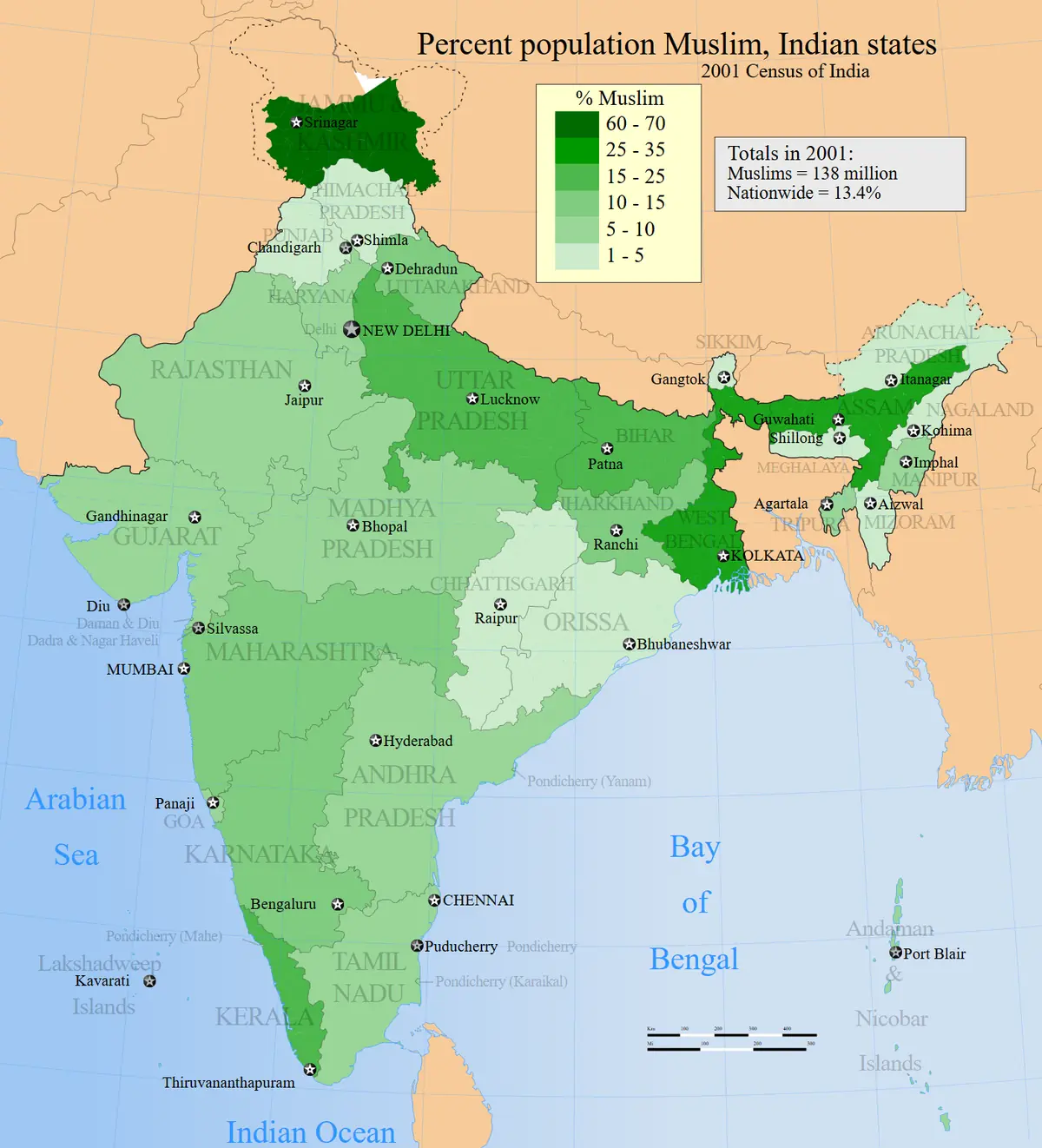
Click or tap the map to enlarge it.
This choropleth map shows the percentage of Muslims in each Indian state and union territory according to the 2001 census, with darker shading for higher proportions. The national figure was 13.4 per cent, or about 138 million people.
A census map like this uses a single count taken on a fixed date, so it is a snapshot rather than a current figure. India's later census in 2011 recorded 14.2 per cent.
Where the share is highest
The union territory of Lakshadweep had the highest proportion at over 95 per cent, followed by Jammu and Kashmir at about 67 per cent. Assam, at around 31 per cent, West Bengal at about 25 per cent and Kerala at about 25 per cent were the large states with the highest shares. Uttar Pradesh was at about 18 per cent, and Bihar at about 17 per cent.
In terms of absolute numbers, Uttar Pradesh, West Bengal and Bihar had the largest Muslim populations because they are very populous.
How to read a percentage map
Percentages and absolute numbers tell different stories. A small state with a high share can contain far fewer people than a large state with a lower share. Choropleth maps also hide variation within states, so district-level data gives a more detailed view.
Key facts
| Area | Share |
|---|---|
| India overall | 13.4% |
| Lakshadweep | About 95% |
| Jammu and Kashmir | About 67% |
| Assam | About 31% |
| West Bengal | About 25% |
| Kerala | About 25% |
Questions about this map
What is a union territory?
A part of India administered directly by the central government rather than as a full state.
Is this data current?
No. The map reflects the 2001 census; the 2011 census gave a national share of 14.2 per cent.
Does the map show absolute numbers?
No, only percentages of each area's population.