Religions Map of India
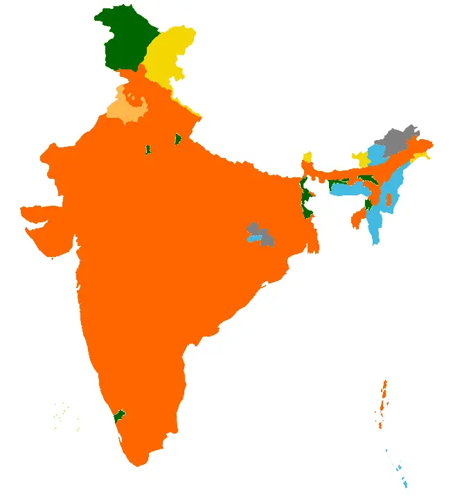
Click or tap the map to enlarge it.
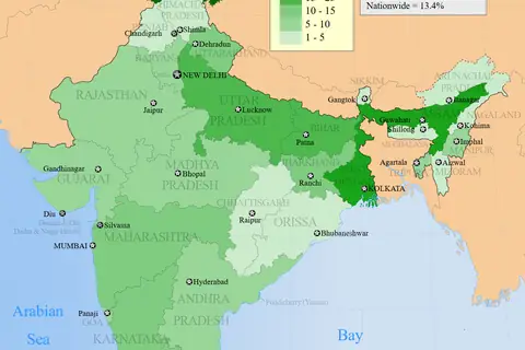
This map of India colours each state and union territory according to its largest religious community. Most of the country is shaded for Hindus, with pockets for Muslims, Christians, Sikhs and Buddhists.
According to the 2011 census, Hindus formed 79.8 per cent of the population, Muslims 14.2 per cent, Christians 2.3 per cent, Sikhs 1.7 per cent, Buddhists 0.7 per cent and Jains 0.4 per cent.
Where minorities are in the majority
Muslims are the largest community in Jammu and Kashmir and in the union territory of Lakshadweep. Christians form the majority in the north-eastern states of Nagaland, Mizoram and Meghalaya. Sikhs are the majority in Punjab, where they make up close to 58 per cent of the population. Buddhists are the largest group in the Leh district of Ladakh, and they form a significant minority in Sikkim.
Beyond these areas, the national map is dominated by Hindu-majority states, but within them there are districts with large Muslim, Christian or tribal populations.
What the map leaves out
A map showing only the largest group per state cannot display the diversity of states such as Kerala, where Hindus, Muslims and Christians all have large communities, or Uttar Pradesh, where there are tens of millions of Muslims. District-level maps from the census provide more detail. Each census is a count of self-declared religion at a point in time.
How religion is recorded in the census
Every ten years the census of India asks households to state their religion, and the answer is self-declared. The 2011 results also include a small share of people who named other religions and persuasions, or who did not state a religion. Because the map colours each state by its largest group, it cannot show the large minorities that exist almost everywhere. For a finer picture, district-level census tables are the better source, and later censuses will update these figures.
Key facts
| Religion | Share |
|---|---|
| Hindu | 79.8% |
| Muslim | 14.2% |
| Christian | 2.3% |
| Sikh | 1.7% |
| Buddhist | 0.7% |
| Jain | 0.4% |
Questions about this map
How often does India count religion?
Every ten years in the national census.
Where do most Sikhs live?
In Punjab.
Why is only the largest group shown?
To keep the map readable; more detail needs district maps.