Map of the Dioceses of Valle del Cauca
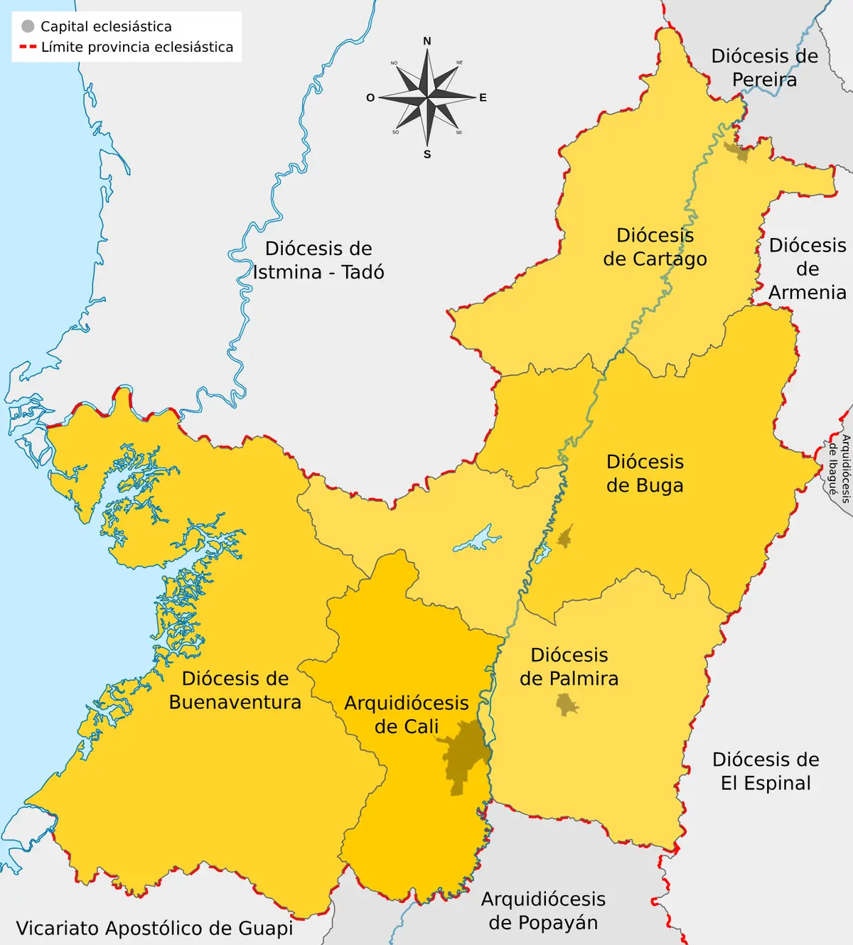
Click or tap the map to enlarge it.
This Spanish-language map shows the Catholic dioceses in the department of Valle del Cauca in south-western Colombia, with boundaries that do not match the civil department borders. Named areas include Cartago, Buga, Palmira and Buenaventura, and neighbouring dioceses such as Armenia.
Church territories follow their own logic. A diocese is led by a bishop and covers a defined area, often built from historic parishes, while the civil map follows municipalities and departments.
Why church and state boundaries differ
Valle del Cauca has its capital in Cali, which is the seat of an archdiocese. Dioceses such as Buga, Cartago, Palmira and Buenaventura belong to the same church province, and each covers municipalities in the department. In places the diocesan line crosses into neighbouring departments such as Chocó, Risaralda or Quindío, which is why a diocesan map needs its own base.
The pattern reflects history. Cartago and Buga are among the older towns of the Cauca valley, while Buenaventura is Colombia's main Pacific port.
Using an ecclesiastical map
Researchers use diocesan maps to study parish registers, which are often held by the diocese that covered a place at the time. Genealogists and local historians should remember that boundaries have been redrawn several times as new dioceses were created.
Key facts
| Diocese | Location |
|---|---|
| Cartago | North of Valle del Cauca |
| Buga | Centre of the valley |
| Palmira | South-east of Valle del Cauca |
| Buenaventura | Pacific coast |
| Armenia | Neighbouring department of Quindío |
Questions about this map
What is a diocese?
A territory of the Catholic Church led by a bishop.
Why do dioceses not match departments?
Church boundaries follow historic parishes and were drawn separately from the civil administration.
Where is Valle del Cauca?
In south-western Colombia, between the Andes and the Pacific.