History
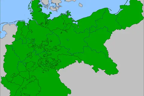
German Empire 1914 Adme Location Map
The German Empire, also known as the Second Reich, existed from 1871 to 1918.
Subject
Empires, wars, borders and old maps that show how the world was divided and understood in the past.
404 maps in this collection
History
The German Empire, also known as the Second Reich, existed from 1871 to 1918.
History
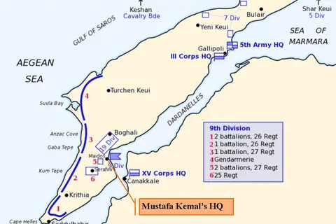
The Map of Turkish Forces at Gallipoli April 1915, also known as the Kemalshq map.
History
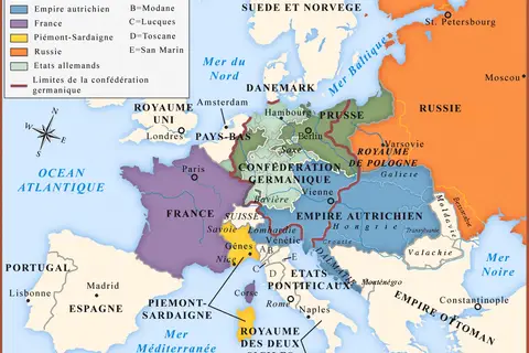
The Congress of Vienna was a diplomatic conference held in Vienna, Austria, from September 1814 to June 1815.
History
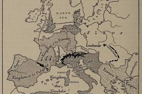
The Map of Europe About 500 AD, featured on page 286 of H.G.
History
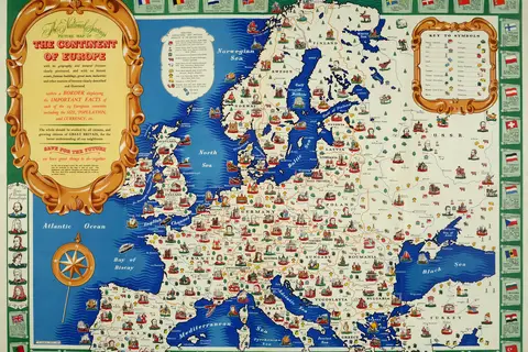
The year 1946 marked a significant juncture in European history, as the continent was gradually recovering from the destruction caused by World War II.
History
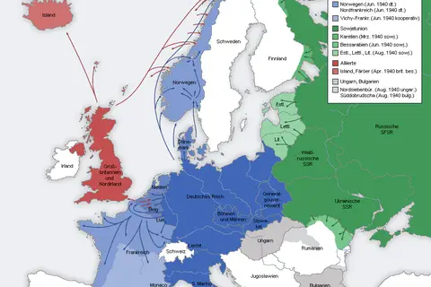
The Second World War was a global conflict that lasted from 1939 to 1945. In 1940, Europe became the primary theater of operations during the war.
History
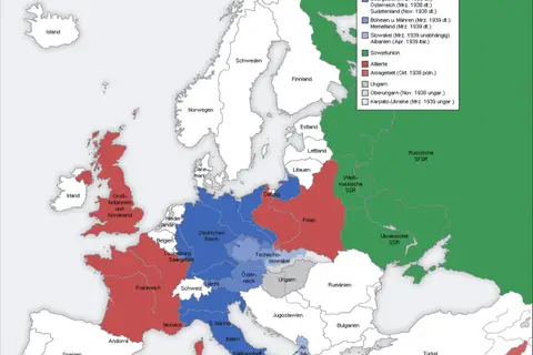
The Second World War Europe 1935-1939 Map De provides a valuable glimpse into the geopolitical situation in Europe during the years preceding the outbreak.
History
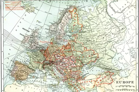
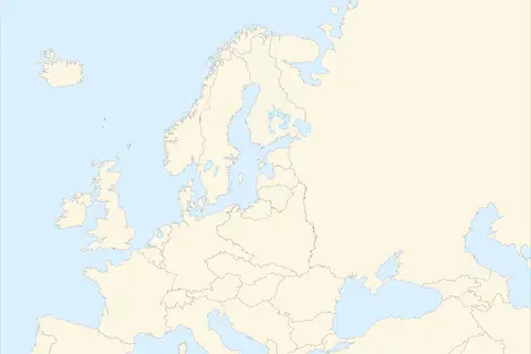
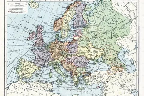
The map of Europe in 1920 reflects the outcome of the Paris Peace Conference held from January 1919 to January 1920.
History
The Europe Map 1919 showcases the political boundaries and territories of European countries immediately following the conclusion of World War I.
History
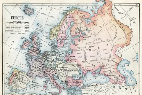
The 1916 political map of Europe reveals the intricate web of alliances, dominions, and occupied territories during a pivotal period in history.
History
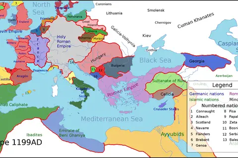
In 1199AD, Europe was a fascinating tapestry of kingdoms, principalities, and empires.
History
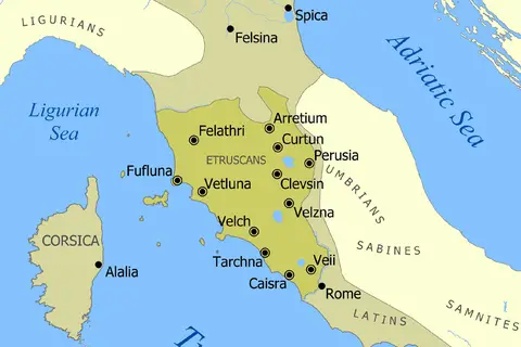
The Etruscan Civilization flourished in central Italy between the 8th and 3rd centuries BCE.
History
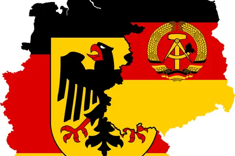
The West Germany East Germany Flag Map represents a significant era in German history.
History
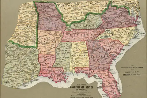
The map of the Confederate States of America, known as “Loc Lva0000071,” is an important historical document that illustrates the geographic boundaries of.
History
The US Map of 1864, focusing on the Civil War divisions, provides a visual representation of the political and territorial situation during that period.
History
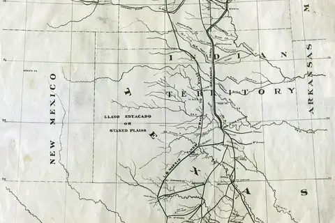
The 1873 Map of Chisholm Trail with subsidiary trails in Texas is a notable cartographic representation of the well-known trail that played a crucial role.
History
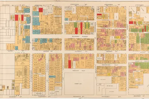
The Willard B Farwell Official Map Of Chinatown, created in 1885.
History
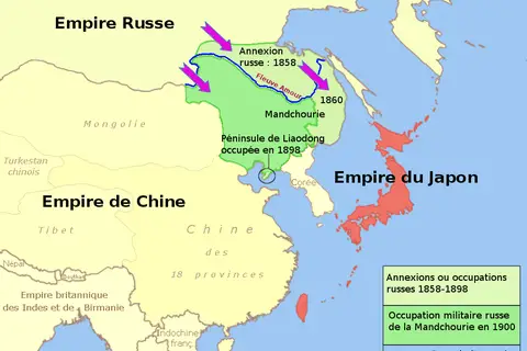
The Russia, China, and Churia Map 1858-1904 provides an insightful glimpse into the intricate dynamics of the region during that time period.
History
The Second Punic War was a conflict that occurred between the years 218 to 201 BCE, primarily between Rome and Carthage.
History
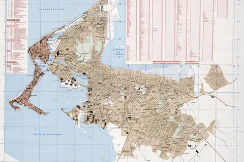
Cartagena, a beautiful city located on Colombia’s Caribbean coast, holds a rich history dating back to its founding in 1533.
History
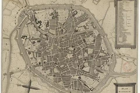
The Map of Bruges Begin 19th Century provides valuable insight into the city’s development during the 1800s.