Old Map of China
Click or tap the map to enlarge it.
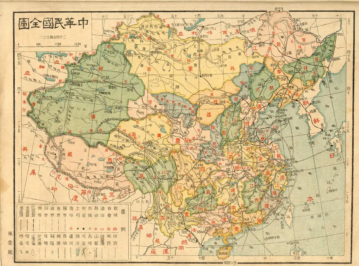
This colour-printed map carries the Chinese title for a complete map of the Republic of China and a scale of 1:24,000,000. It shows the country's provinces and dependencies in different colours, with railways, boundaries and a key at the lower left.
The Republic of China was founded on 1 January 1912, after the fall of the Qing dynasty. The province names on this sheet, including Fengtian, Rehe (Jehol), Chahar and Suiyuan, suggest a date in the 1910s or 1920s.
What the colours and labels reveal
Mainland China is divided into its provinces, with large regions of Xinjiang, Qinghai, Tibet and Mongolia drawn across the west and north. Chahar, Rehe and Suiyuan were special districts created in the early Republic, in the area between the provinces and Mongolia. Korea appears to the east of the mainland; Japan had annexed it in 1910.
Boundaries with neighbouring countries are shown with a different line style from provincial boundaries, and railway lines are drawn to show the growing network that connected the coast with the interior.
Why old Chinese maps are useful
Maps like this one record administrative names that were later changed or abolished. Fengtian province, for example, became Liaoning in 1929, and Rehe, Chahar and Suiyuan were later absorbed into neighbouring provinces and regions. They also show how the Republic claimed territory, such as Outer Mongolia, whose status was already disputed.
Key facts
| Feature | Detail |
|---|---|
| Title | Complete map of the Republic of China (in Chinese) |
| Scale | 1:24,000,000 |
| State shown | Republic of China, founded 1 January 1912 |
| Likely date | 1910s to 1920s, from the province names |
| Fengtian renamed Liaoning | 1929 |
Questions about this map
How is the map dated?
No date is quoted here, so the period is inferred from administrative names that existed only in the early Republic.
What language are the labels in?
Chinese, in traditional characters.
Why does the map show Korea as Japanese?
Japan annexed Korea in 1910 and held it until 1945.