Henri Chatelain’s Map of the Iberian Peninsula (1710s)
Click or tap the map to enlarge it.
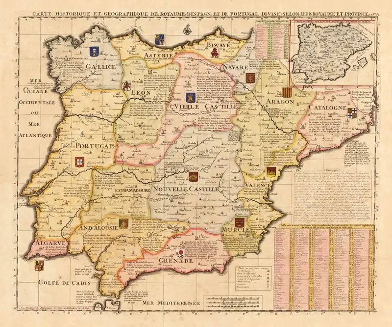
This hand-coloured engraving, titled in French as a historical and geographical map of the kingdoms of Spain and Portugal divided into their principal provinces, was published by Henri Abraham Chatelain in the 1710s. Province names such as Galice, Asturies, Biscaye, Navarre, Aragon, Catalogne, Vieille Castille, Nouvelle Castille, Valence, Grenade and Algarve appear in the body of the map.
Chatelain was a Huguenot pastor and cartographer who worked in Amsterdam, and his Atlas historique combined maps with historical and genealogical notes.
Maps that carried history
What distinguishes Chatelain's work from many maps of the time is the information that fills the margins. Coats of arms mark provinces, and the tables at the right of the sheet give historical notes on the provinces. The colours are applied by hand, a typical feature of eighteenth-century printed maps, and the engraving is decorated with a title cartouche.
Spain in this period was ruled by Philip V of the House of Bourbon, who took the throne in 1700 after the death of the last Spanish Habsburg, Charles II. The War of the Spanish Succession, which followed, ended with the Treaties of Utrecht in 1713.
Reading old provincial boundaries
The provinces shown correspond to the historic kingdoms and regions that made up the Iberian monarchies, including Aragon and Castile as separate entities and Navarre. These do not match modern autonomous communities, though many names survive.
Chatelain's atlas
The map comes from Chatelain's Atlas historique, published in Amsterdam in several volumes between 1705 and 1720. It combined maps with essays on history, genealogy and geography, and was reprinted into the late 1730s. The atlas was designed to be read, not merely consulted, which is why the maps carry so much written information. Its engraved titles and decorative borders are typical of Dutch map publishing in the early eighteenth century.
Key facts
| Fact | Detail |
|---|---|
| Mapmaker | Henri Abraham Chatelain |
| Place of publication | Amsterdam |
| Period | 1710s |
| Language | French |
| Spanish succession settled | Treaties of Utrecht, 1713 |
Questions about this map
Who was Chatelain?
A Huguenot pastor and cartographer based in Amsterdam, known for his Atlas historique.
Why are the margins filled with text?
Chatelain intended his atlas to teach history and geography together.
Is the original in the public domain?
Yes, a work of the early eighteenth century is out of copyright.