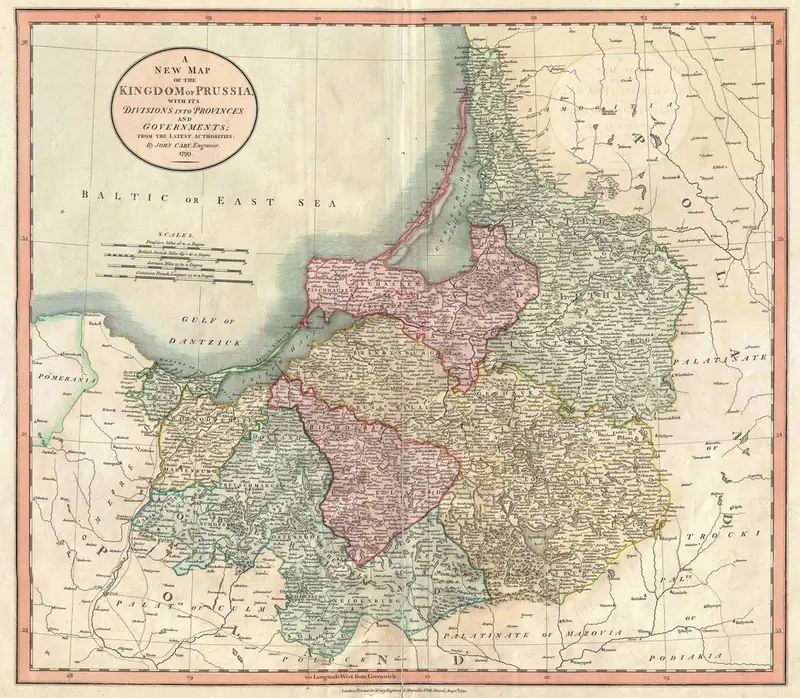
“New Map of the Kingdom of Prussia”, 1799
Click or tap the map to enlarge it.
This hand-coloured engraving, titled 'A New Map of the Kingdom of Prussia', was published in London by the mapmaker John Cary in 1799. It shows the eastern lands of the kingdom, with the Baltic coast on the north, divided into provinces and governments in different colours.
Cary (1755 to 1835) was one of the leading English cartographers of his generation and was known for clear engraving and accurate road maps.
Prussia at the end of the century
In 1799 the Kingdom of Prussia, proclaimed in 1701, was one of Europe's great powers. It had gained large areas of Poland in the partitions of 1772, 1793 and 1795, including West Prussia, South Prussia and New East Prussia. These acquisitions explain why maps of the period are divided into many provinces and governments.
The kingdom's heartland lay in Brandenburg, but its territory stretched across the north European plain to the Baltic and beyond the Vistula.
A map as a product
Cary's map was made for the English-speaking market, as many commercial maps were. It cites 'the latest authorities', a reminder that publishers relied on earlier surveys. The engraving would have been coloured by hand, and the borders are drawn to show which areas belonged to each province. Within a decade the Napoleonic Wars would redraw this map entirely.
Cary and the English map trade
John Cary worked from premises on the Strand in London and published atlases such as the New and Correct English Atlas of 1787 and the New Universal Atlas of 1808. He also surveyed roads for the Post Office in the 1790s. English mapmakers of this period often built their maps of continental Europe from German and French sources, and then added the clear lettering and colouring that made their sheets popular with British buyers.
Key facts
| Fact | Detail |
|---|---|
| Mapmaker | John Cary, London |
| Date | 1799 |
| Kingdom of Prussia proclaimed | 1701 |
| Partitions of Poland | 1772, 1793, 1795 |
Questions about this map
Who was John Cary?
An English engraver and cartographer who published atlases and road books.
Why are there so many provinces?
Prussia had gained Polish territory in the partitions and organised it into new provinces.
Is the map accurate?
For its time it was careful, but it reflects the surveys then available.