History
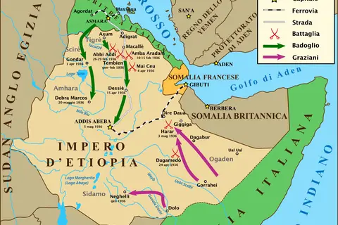
Ethiopia War Map May 1936 It
The Ethiopia War in May 1936 It was a military conflict between the forces of Italy, led by Benito Mussolini, and Ethiopia (then known as Abyssinia).
Subject
Empires, wars, borders and old maps that show how the world was divided and understood in the past.
404 maps in this collection
History
The Ethiopia War in May 1936 It was a military conflict between the forces of Italy, led by Benito Mussolini, and Ethiopia (then known as Abyssinia).
History
The Mapa De España Constitución De 1873 depicts Spain during the era of the 1873 Constitution, also known as the First Spanish Republic.

History
The Empire of Japan, also known as the Imperial Japan or Imperial Way Faction, was an era in Japanese history that lasted from 1868 to 1947.
History
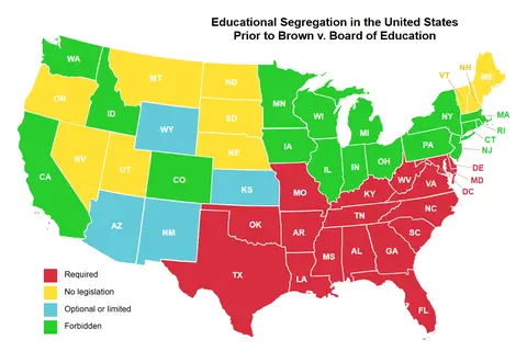
Educational Separation In The US Prior To Brown Map Key Takeaways Educational separation in the US prior to Brown vs. Board of Education was prevalent.
History
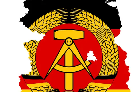
The Flag Map of East Germany 1959-1990 depicts the territorial boundaries and flag design of the German Democratic Republic (GDR) during the Cold War era.
History
The D-Day Landings, which occurred on June 6, 1944, were a major military operation during World War II.
History
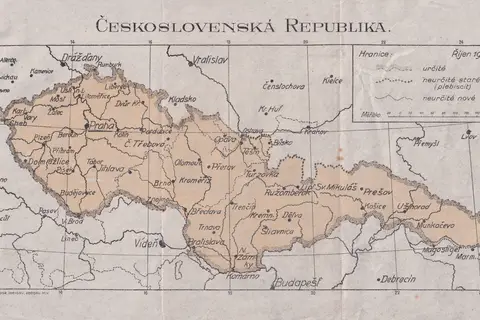
The Czechoslovak Republic Map of 1919 illustrates the borders and geography of the newly founded independent country, known as Czechoslovakia.
History
The Siege of Constantinople in 1453 was a monumental event that shaped the course of history.
History
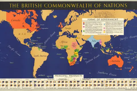
The 1942 map of the world showing the British Commonwealth of Nations provides a unique perspective on the global political scenario during the time of.
History
The American Revolutionary War, which lasted from 1775 to 1783, played a pivotal role in shaping the history of the United States.
History
The Map Thirteen Colonies 1775Es represents the geographical layout of the thirteen British colonies that were present on the eastern coast of North.
History
The map of Africa in 1939 represents a crucial era in the continent’s history.
History
The “Mapa Del Frica Colonial 1914 Ast” is a significant cartographic artifact that showcases the colonial presence in Africa during the year 1914.
History
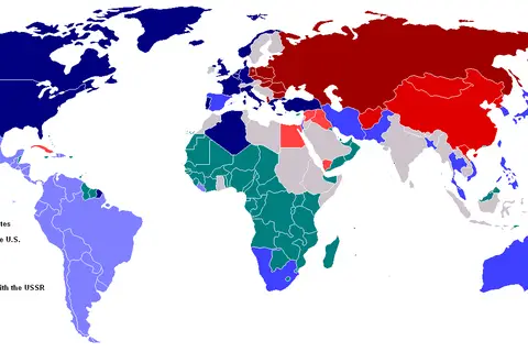
The Cold War, mainly characterized by political and military rivalry, divided the world into two major spheres of influence.
History
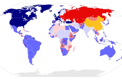
The Cold War, a period of political and ideological rivalry between the United States and the Soviet Union.
History
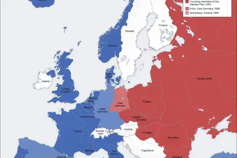
The Cold War, which lasted from the late 1940s to the early 1990s, was characterized by political, ideological.
History
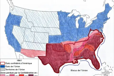
The American Civil War, which took place from 1861 to 1865, was a major conflict fought primarily between the northern states (Union) and the southern.
History
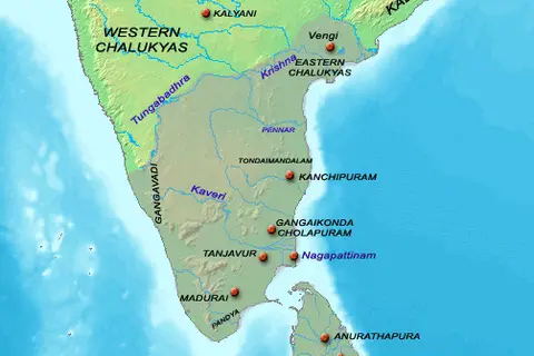
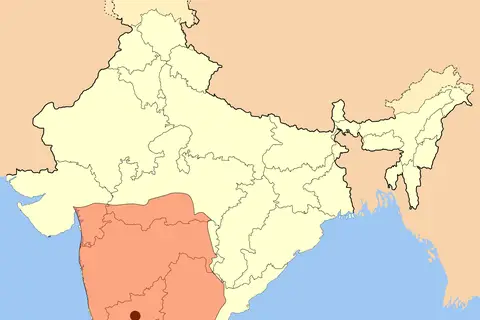
The Chola Map, created during the Chola dynasty’s reign from the 9th to the 13th century, provides an invaluable representation of their vast empire.
History
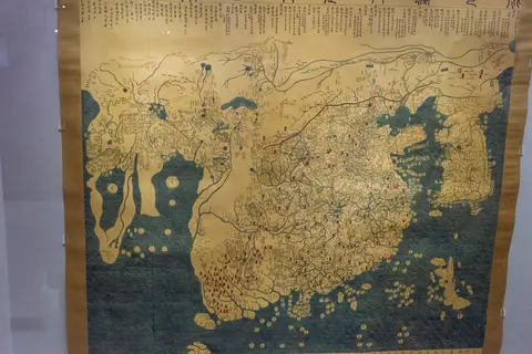
The Old Map of China and Korea holds significant historical importance.
History
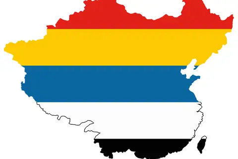
The Flag Map of the Republic of China from 1912- 1928 represents a significant period when China was transitioning from imperial rule to a republican.

History
The Qing Empire, also known as the Qing Dynasty, was the last imperial dynasty of China. It spanned from 1644 to 1912 and was founded by the Manchu people.
History
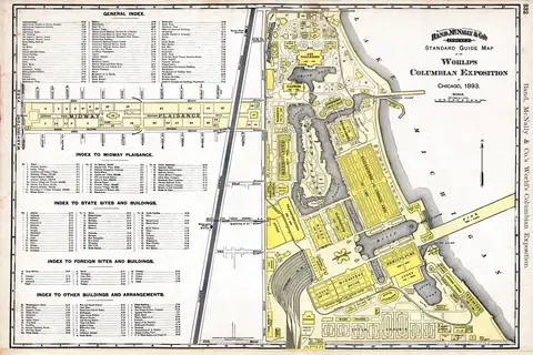
The 1893 World’s Columbian Exposition, held in Chicago, Illinois.
History
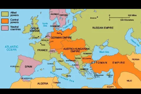
The Map of Allied Powers during World War I represents the geopolitical landscape of the war that took place between 1914 and 1918.